Our guest blogger today is Tracy Hadden Loh with the Rails to Trails Conservancy.
The Rails-to-Trails Conservancy is a national membership-based nonprofit dedicated to creating a nationwide network of trails from former rail lines and connecting corridors to build healthier places for healthier people. We serve as the national voice for more than 160,000 members/supporters, 30,000 miles of rail and multi-use trails, and over 8,000 miles of potential trail. When RTC was founded in 1986, there were less than 250 miles of rail-trail in the United States. Today, there are more than 21,000 miles of trails of serving some tens of millions of people each year.
However, that mileage number is about all we’ve measured with any precision. We don’t actually know how many people in the United States use trails each year. We know that these miles of trail are a great way to create healthier places and healthier people – for example, a recent meta-analysis of published research on the cost-effectiveness of population-level interventions to promote physical activity found that a rail-trail was the #1 most effective intervention. On the basis of similar evidence, the Centers for Disease Control and Prevention recognize trails as a proven strategy that works to increase physical activity, reduce risk of chronic disease, and improve mental health and wellness. So we know we’re on to something good – but how good? When it comes time to make room for trails in the budget, can we show a dollars-and-cents return on investment?
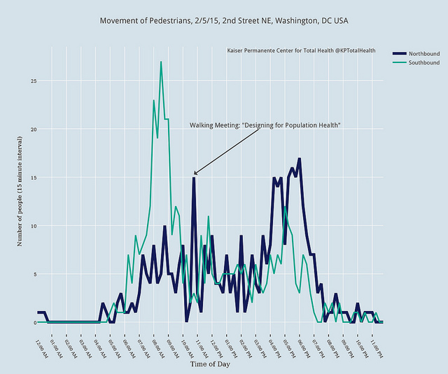
To that end, RTC has launched the Trail Modeling and Assessment Platform (T-MAP), a three-year research initiative to measure, model, and value trail use in the United States. The first phase of this project involves establishing a national network of trail traffic monitoring stations, so that we can continuously measure trail use across the different climactic zones of the US. We’ll use these data to develop two tools: a trail use demand forecasting model to estimate traffic volumes on existing trails or predict volumes on future trails; and a health impact assessment calculator for estimating health care costs avoided due to physical activity on trails.
Taken literally, RTC’s focus on “health” means that there are times when our mission overlaps with that of hospitals and health care systems. Under the Affordable Care Act, non-profit hospitals are now faced with a requirement to assess the health needs of the community, and based on that assessment draw up an implementation plan. We see that as an opportunity to make the case for trails!
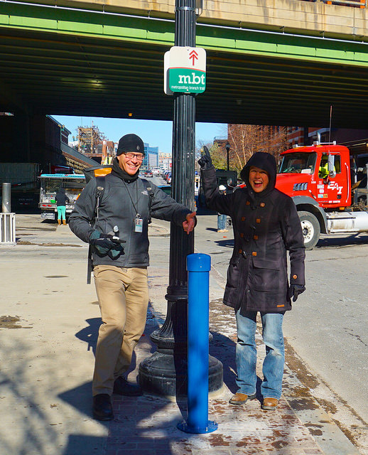
Our partners at the Kaiser Permanante Center for Total Health already get it. Located in the heart of downtown Washington, DC right on the Metropolitan Branch Trail, the CTH is helping us implement T-MAP through the installation and maintenance of their very own trail traffic monitoring station, contributing critical data to the project from a unique trail location that is co-located with an urban sidewalk, and dominated by pedestrians. As they learn about how the trail relates to their facility, we’re learning about the trail and collecting the data necessary to accurately estimate the true magnitude of trail use in the United States, and what it’s worth.